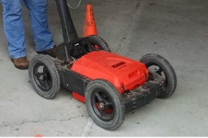
Ground-Penetrating Radar can be used to map subsurface stratigraphy including sand and gravel lenses, clay lenses, peat and organics, and bedrock where it is expected to be less than about 5-10 meters, and the overburden is unsaturated and contains little clay or silt. If these conditions exist, then penetration depths may be a few meters to a few tens of meters.
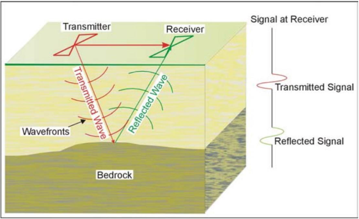
The GPR instrument consists of a recorder and a transmitting and receiving antenna. The figure below provides a drawing illustrating the GPR system. The transmitted electromagnetic signals penetrate the ground and are reflected from boundaries with differing dielectric properties. The reflected waves are detected by the receiver and displayed and stored in the instrument.
Data Acquisition
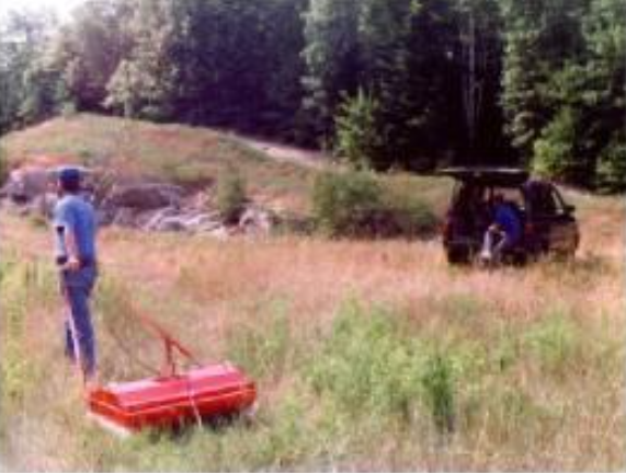
Data can be acquired using a transmitter/receiver mounted in a single antenna, or by using separate transmit/receive antennas. GPR data can be acquired using different antenna frequencies varying between 25 and 3000 MHz. Lower frequency antennas provide greater penetration depths but lower resolution. Higher frequency antennas provide less depth penetration but better resolution. For stratigraphic surveys, data is typically acquired using frequencies of 25 to 500 MHz. GPR surveys are conducted by pulling the antenna across the ground surface at a normal walking pace. Data is either acquired along a marked survey grid using an encoder wheel to acquire data at fixed intervals, or the system is synced with GPS for accurate horizontal positioning.
Data Processing
GPR datasets may be processed similar to reflection seismic datasets. Processes that may be applied include gain adjustment, distance normalization, horizontal scaling (stacking), vertical and horizontal filtering, velocity corrections, and migration. However, depending on the data quality, this may not be done since the field records may be all that is needed to observe the bedrock.
Data Interpretation
The data is usually interpreted visually. If the target is a stratigraphic horizon (clay layer, sand/gravel deposit, bedrock), a horizontal, or sub horizontal, reflector would be observed at close to the expected depth. To calculate the depth to the interface, the speed of the GPR signal in the material above the interface needs to be determined. This can be estimated from textbook speeds for typical soil types, or it can be obtained in the field by conducting a small traverse across a buried feature whose depth is known. While reflections from stratigraphic horizons may be evident in the processed sections, caution must be taken with depth estimations as the propagation velocity of the signal may vary widely horizontally and vertically across the section and depths may be inaccurate.
Interpretation of GPR data for bedrock fractures involves searching for either flat reflectors (if the fractures are sub-horizontal) or steeply dipping reflectors or hyperbolic signatures (if the features are near vertical). In addition, if the fracture zone is saturated, the GPR signal may be strongly attenuated, so such zones may be obvious in the GPR records.
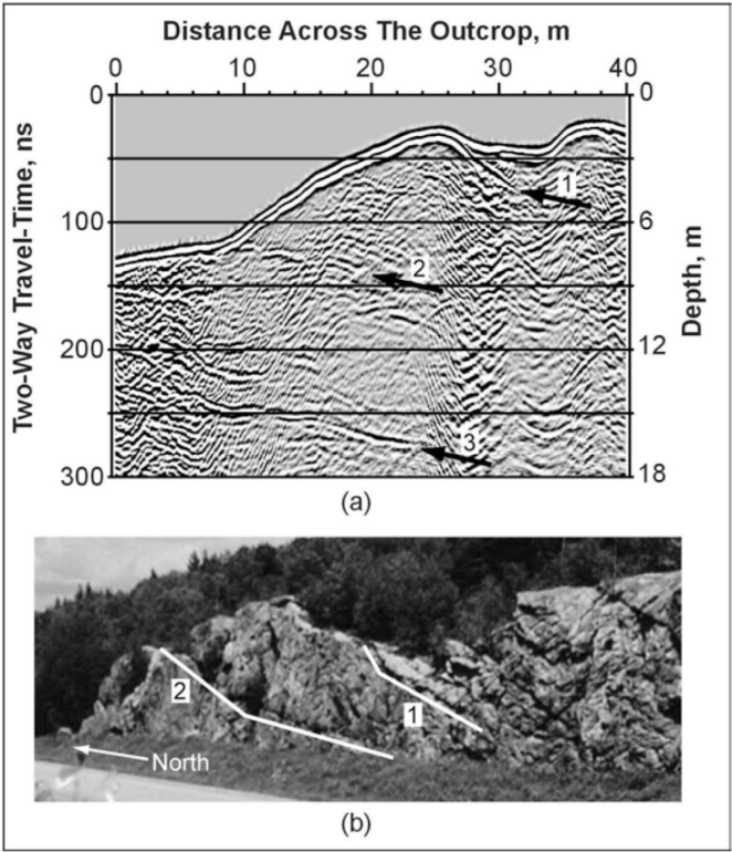
The figure below presents a GPR profile over an outcrop with two obvious subparallel fracture zones. In this case, the bedrock is quite shallow, and very little soil is present over the bedrock surface, therefore, the GPR reflections are strong and easily interpreted. Two fractures are obvious in the GPR data and in the outcrop (fractures 1 & 2). A third fracture is obvious in the GPR data but is below the base of the outcrop and cannot be seen visually.
Deliverables
Results of GPR surveys are typically provided as 2D profiles showing depth corrected sections with interpreted interfaces, objects, and other pertinent features. If the survey has sufficient horizontal coverage, 3D topographic plots can be generated for surfaces identified in the profiles.
Advantages
GPR surveys are non-invasive and large amounts of data can be acquired quickly, providing a very high data density at a relatively low cost. GPR data can be recorded quickly, and the data is presented on a screen during the survey allowing its quality to be evaluated and allows for crude in-field interpretation. Different antennae, providing different penetration depths and resolution, can easily be tested.
Limitations
Probably the most limiting factor for GPR surveys is that their success is very site specific and depends on having a contrast in the dielectric properties of the target compared to the host overburden along with sufficient depth penetration to reach the target. In complex geologic environments where several stratigraphic units are present, it may be very difficult to assess the true depth of the interfaces as the propagation velocities will vary rapidly. While it may be relatively simply to detect and interpret interfaces and fractures, intrusive information is required to assist with the identification of the interfaces.