Mapping subsurface voids, sinkholes, abandoned mines, and other cavities is critical for mitigating geotechnical hazards that can threaten infrastructure, public safety, and environmental resources. These features often develop in karst terrain, old mining districts, reclaimed land, and areas with highly variable soil and rock conditions. Seismic Full Waveform Inversion (FWI) provides a high-resolution, nondestructive approach for detecting and characterizing such subsurface anomalies by analyzing the complete seismic wavefield.
Data Acquisition
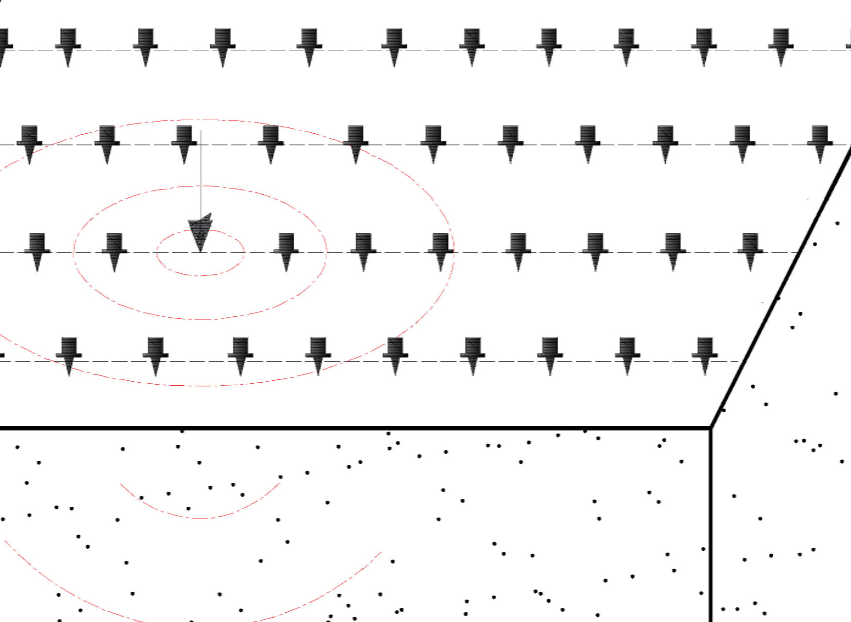
FWI surveys for cavity and void detection are conducted using controlled seismic sources and dense arrays of receivers deployed along linear profiles or over an area, depending on the size and complexity of the site. Seismic energy is generated using sources such as impact hammers, weight drops, or propelled energy generators, and the resulting wavefields are recorded by closely spaced geophones or distributed acoustic sensing (DAS) systems at the ground surface. The 3D SPT seismic method is also applicable for mapping voids and other cavities; see the application page FWI for Mapping Stratigraphy for more details on this method.
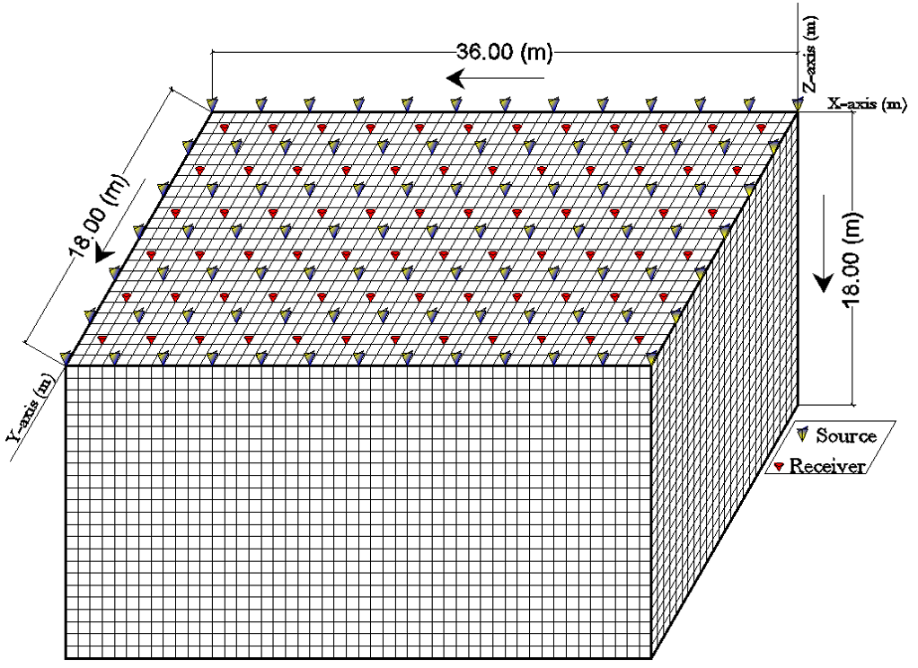
High spatial sampling is required to adequately capture scattered and diffracted wave energy associated with subsurface voids and cavities. Acquisition geometry is designed to ensure sufficient source–receiver offsets and coverage for a range of angles from the source so that 3D wave propagation effects can be resolved when needed. Recording time windows are selected based on the expected depth of investigation and subsurface wave velocities, ensuring that reflections, refractions, surface waves, and scattered waves generated by cavities are fully captured.
Data Processing
Initial processing of seismic data typically includes geometry assignment, quality control, filtering, amplitude normalization, and noise attenuation. The processed data are then used in the FWI workflow, which involves constructing an initial subsurface velocity model and performing numerical forward modeling of seismic wave propagation. The difference between observed and simulated waveforms is quantified, and the subsurface model is iteratively updated until the difference is minimized.
For cavity detection applications, FWI processing emphasizes accurate modeling of elastic wave propagation so that low-velocity zones, strong impedance contrasts, and scattering effects associated with voids and mine workings are preserved. Multiscale inversion strategies are commonly employed, beginning with lower frequencies to establish the background velocity structure and progressing to higher frequencies to enhance resolution of smaller features.
Data Interpretation
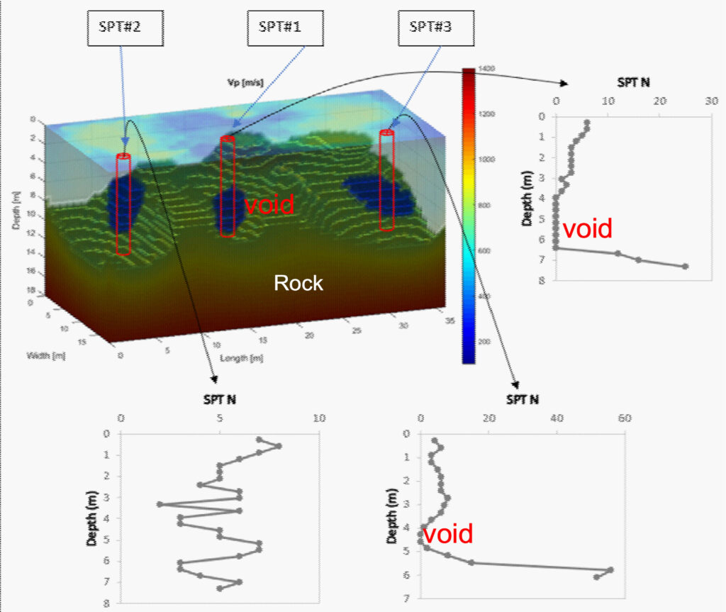
FWI results are interpreted by examining 2D cross sections or 3D velocity volumes for anomalous zones indicative of voids, sinkholes, or abandoned mine features. Subsurface cavities typically appear as localized low-velocity zones, zones of disrupted or chaotic wave propagation, or areas with strong lateral velocity gradients relative to the surrounding material.
The spatial extent, depth, and geometry of these anomalies can be evaluated directly from the inverted velocity models. When combined with site history, borehole data, or other geophysical methods, FWI results provide a robust basis for distinguishing natural karst features from anthropogenic mine voids and for assessing the potential for future subsidence or collapse.
Deliverables
Deliverables for FWI-based cavity mapping typically include processed seismic datasets, high-resolution 2D cross sections or 3D velocity volumes highlighting anomalous zones, and interpreted figures such as profiles, depth slices, and iso-surfaces. A technical memorandum is also provided summarizing the survey objectives, data acquisition parameters, processing workflow, interpretation of identified cavities or voids, and limitations of the results. Where appropriate, zones of concern may be delineated for follow-up investigation or remediation planning.
Advantages
Seismic FWI provides significantly higher resolution and greater sensitivity to subsurface cavities than conventional refraction or surface-wave methods. The technique makes use of the full seismic waveform, allowing it to detect embedded low-velocity zones and complex features that may be missed by seismic refraction tomography. FWI is a nondestructive method that can be applied over large areas and does not require drilling or excavation during initial site assessment. The method is well suited for sites with complex geology where voids and sinkholes may not be laterally continuous or easily detected using simpler geophysical techniques.
Limitations
The effectiveness of FWI depends on data quality, survey design, and the accuracy of the initial velocity model. Highly attenuative soils, strong cultural noise, or limited site access can reduce data quality and affect resolution. 3D FWI surveys require greater field effort and computational resources than 2D surveys. As with all geophysical methods, interpretation of FWI results is non-unique and is most reliable when integrated with geologic information, borehole data, or complementary geophysical surveys.